Tuesday, June 11, 2013

HIKE 12: Agawam Public Libary to Longmeadow Green on Longmeadow st. Longmeadow MA

HIKE 12: Agawam Public Library 750 Cooper St, Agawam, MA to Longmeadow Green 
Longmeadow St. (Rt.5)- LongmeadowDISTANCE - Approximately  8 Miles
PARKING -
  • Agawam Public Library 750 Cooper St, Agawam, MA 01001
  • Longmeadow Green - Longmeadow St. (Rt.5)- Longmeadow


HIKE 11: Holyoke Visitors Center to Agawam Public Library

HIKE 11: Holyoke Visitors Center 221 Appleton St. Holyoke, MA 01040 to Agawam Public Library 750 Cooper St, Agawam, MA
DISTANCE - Approximately  12 Miles
PARKING -
  • Holyoke Visitors Center 221 Appleton St. Holyoke, MA 01040
  • Agawam Public Library 750 Cooper St, Agawam, MA 01001
For This Hike we will be following back roads along the CT River.


HIKE 10: South Hadley Public Library to Holyoke Visitors Center (EASIEST HIKE OF THE WHOLE TOUR!)

HIKE 10: South Hadley Public Library 27 Bardwell Street - South Hadley  to Holyoke Visitors Center 221 Appleton St. Holyoke, MA 01040
DISTANCE - Approximately  1.3 Miles
PARKING -
  • Parking is available at the South Hadley Public Library 27 Bardwell Street - South Hadley
  • Holyoke Visitors Center 221 Appleton St. Holyoke, MA 01040


HIKE 9:Belchertown to South Hadley Public Library PART 2

HIKE 9: Clapp Memorial Library in Belchertown 19 S Main St  Belchertown, MA 01007 to South Hadley Public Library 27 Bardwell Street - South Hadley (PART 2) 
DISTANCE - Approximately  6 Miles
PARKING -
  • Closest Parking to The Cabin is  Hadley, MA 01035
  • Parking is available at the South Hadley Public Library 27 Bardwell Street - South Hadley
We Will finish Our hike to the South Hadley Public Library via the NET to the parking area listed above and then down route 47 to the South Hadley Public Library.


HIKE 8: Clapp Memorial Library Belchertown to South Hadley Public Library via NET over the Holyoke Range (Part 1)

HIKE 8: Clapp Memorial Library in Belchertown 19 S Main St  Belchertown, MA 01007 to South Hadley Public Library27 Bardwell Street - South Hadley
DISTANCE - Approximately 15 Miles
PARKING -
  • Parking is Available at Clapp Memorial Library in Belchertown 19 S Main St  Belchertown, MA 01007
  • Parking is available at the South Hadley Public Library 27 Bardwell Street - South Hadley
For This Hike we will hike back roads to the NET trail head on Bay Road and then walk the NET over the Holyoke Range.

Here are Directions to the trail head :


Then once we are on the NET  sections 7 & 8(White Blazes) we will be hiking the Holyoke Range to the Mt. Holyoke Outing Club Cabin


HIKE 7: Hadley, MA to Clapp Memorial Library in Belchertown

HIKE 7: Hadley, MA to Clapp Memorial Library in Belchertown 19 S Main St  Belchertown, MA 01007DISTANCE - Approximately 13 Miles
PARKING -
  • The Hitchcock Center for the Environment 525 South Pleasant Street - Amherst
  • Parking is Available at Clapp Memorial Library in Belchertown 19 S Main St  Belchertown, MA 01007


HIKE 6: Red Fire Farm Montague to The Hitchcock Center for the Environment 525 South Pleasant Street - Amherst

HIKE 6:  Red Fire Farm 184 Meadow Road, Montague, MA 01351 to The Hitchcock Center for the Environment 525 South Pleasant Street - Amherst
DISTANCE - Approximately 13 Miles
PARKING -
  • Parking Available at Red Fire Farm 184 Meadow Road, Montague, MA 01351   
  • The Hitchcock Center for the Environment 525 South Pleasant Street - Amherst
For this hike we will be walking back roads along the CT River and then we will parade through Amherst to arrive at The Hitchcok Center.


Monday, June 10, 2013

HIKE 5: Hidden Valley Memorial Forest to Red Fire Farm in Montage, MA

HIKE 5: Hidden Valley Memorial Forest to Red Fire Farm 184 Meadow Road, Montague, MA 01351
DISTANCE - Approximately 9 Miles
PARKING -
  • Park at Wendell State Forest Headquarters on Montague Road - Wendell Registration and Event Details . This Event includes a hike or shuttle to the show location
  • Parking Available at Red Fire Farm 184 Meadow Road, Montague, MA 01351   

For this hike we will depart from the NET to follow back roads to our performance at Red Fire Farm.


HIKE 4 - Erving Evangelical Congregational Church to Hidden Valley Memorial Forest


HIKE 4 -  Erving Evangelical Congregational Church to Hidden Valley Memorial Forest
DISTANCE - Approximately 12 Miles
PARKING -
  • Evangelical Congo Church - 4 East Main Street - Erving 
  • Park at Wendell State Forest Headquarters on Montague Road - Wendell Registration and Event Details . This Event includes a hike or shuttle to the show location
Here is the route we plan to use. We will be taking Mountain Road to the trail head for NEST. Then Following NEST along Farley Cliffs etc. down to Hidden Valley Memorial Forest. The park is asking folks to meet at Park HQ on Montague road for a shuttle over to the event and a short hike into the woods.


**IF THE WEATHER IS POOR WE WILL BE CUTTING OUT THE FARLEY LEDGES SECTION OF THE TRAIL AND WILL USE THIS ROUTE BELOW**

DISTANCE - Approximately 6.5  Miles


HIKE 3 - Warwick Town Hall to Erving Evangelical Congregational Church

HIKE 3 -  Warwick Town Hall to Erving Evangelical Congregational Church 
DISTANCE -  8.5 Miles
PARKING -
  • Parking available at Warwick Town Hall 12 Athol Road Warwick, MA 01378
  • Evangelical Congo Church - 4 East Main Street - Erving 
Here is the route we plan to use. We will be taking roads into Erving State Forest and then using trails Through Erving State Forest.

For a More close up Map of the Erving State Forest Summer Trails download here


12 Athol Rd, Warwick, MA 01378
4 E Main St, Erving, MA 01344


Friday, June 7, 2013

HIKE 2 - Trustees Shelter to Warwick Town Hall

HIKE 2 -  Trustees Shelter to Warwick Town Hall along the NET Section 18
DISTANCE -  Approx. 8  miles
PARKING -

  • Closest parking to the Trustees shelter is 
Royalston, MA 01368
  • Parking is available at Warwick Town Hall 12 Athol Rd, Warwick, MA 01378


We plan to follow the NET from the Trustees Shleter to the Parking Area on Route 78 where we will leave the trail and Follow Route 78  into Warwick.
Here is the route we plan to use along the New England Scenic Trail (follow the white blazes):


Thursday, June 6, 2013

HIKE 1- Tully Trail to Trustees Shelter

HIKE 1 - Tully Trail to Trustees Shelter M&M Trail Head
DISTANCE -  Approx. 6 miles
PARKING -
  • There is parking available across from the campground at 25 Doanes Hill R. Royalston, MA 01368
  • The closest parking to the Trustees  Shelter is at 
    Royalston, MA 01368
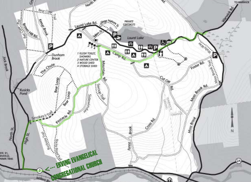
For the first day we will be hiking the Tully Trail from the Tully Lake Campground  up to the trustees shelter at the norther end of the park
If you prefer the full park map from the trustees you may download it here

Here is the section we will be completing.


New Website!!

Check out our newly redesigned website www.masswalkingtour.org

You can also donate to the Massachusetts Walking Tour via Pay Pal

MA Walking Tour CD Vol. II Have Arrived!

If you would like to order an advanced copy of the Massachuestts Walking Tour Vol. II You may do so via Paypal.